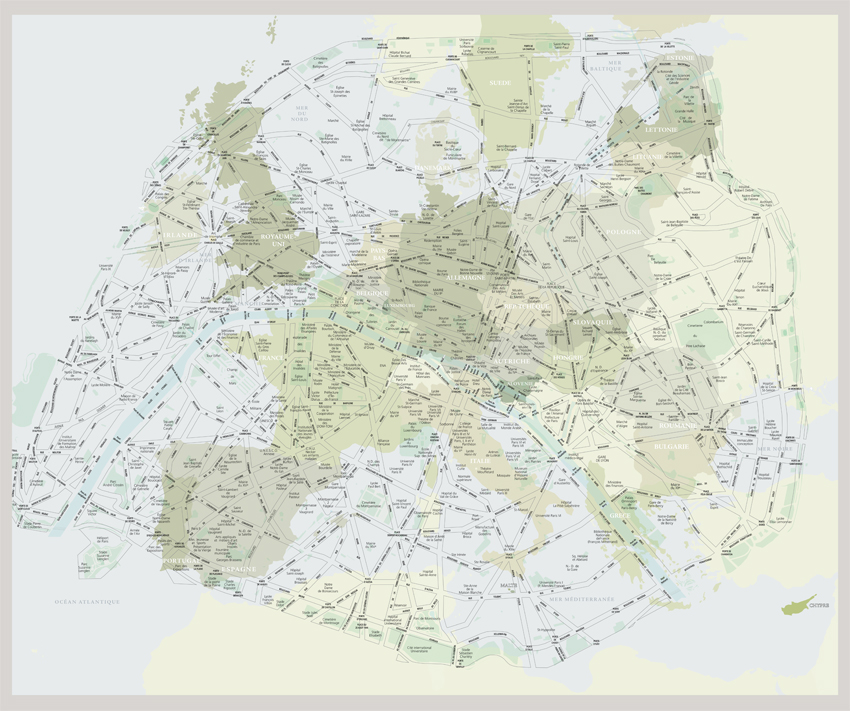
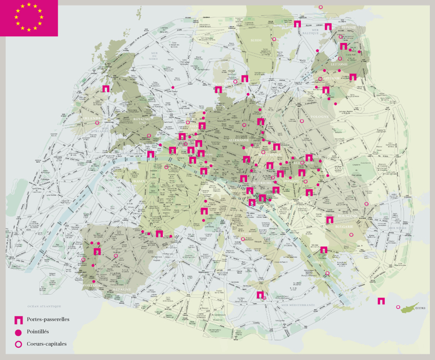
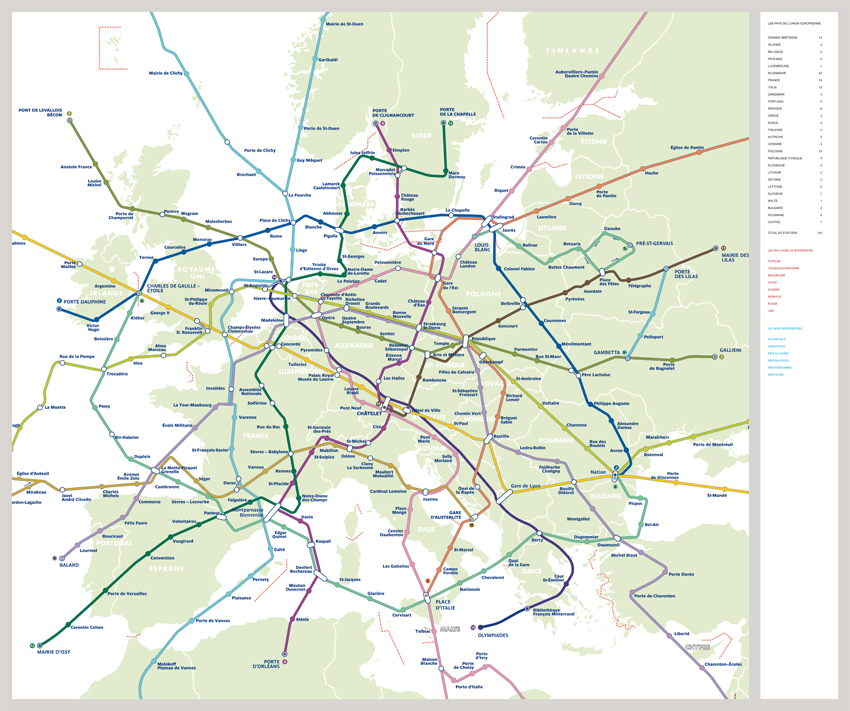
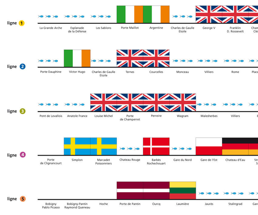
The concept is as simple as it is effective. It is a machine for imagining. It involves superimposing the map of Europe to a scaled map of Paris. 1 m2 of Paris corresponds to 25 hectares of Europe. By initiating this idea, the urban fabric changes. Each European country sets up in a neighbourhood of Paris and new quarters take shape. So in taking a tour of Paris, we survey the entire continent. Inventing such a super map implies symbolically inviting Europe to inhabit the french capital and vice versa, Paris taking form throughout Europe.
Through this mental gymnastic, we are activating the imaginary and initiating a call to playfulness. In so using what is at first a mind game, we are virtually projected into Europe. Through being superimposed on our familiar, daily environment, with which we have an intimate relationship, Europe enters into the emotional level and hence into a questioning: what relationship do I have with Europe? In this way we are stimulating the possibility of a personal relationship with the continent, of an appropriation and a response from everyone.
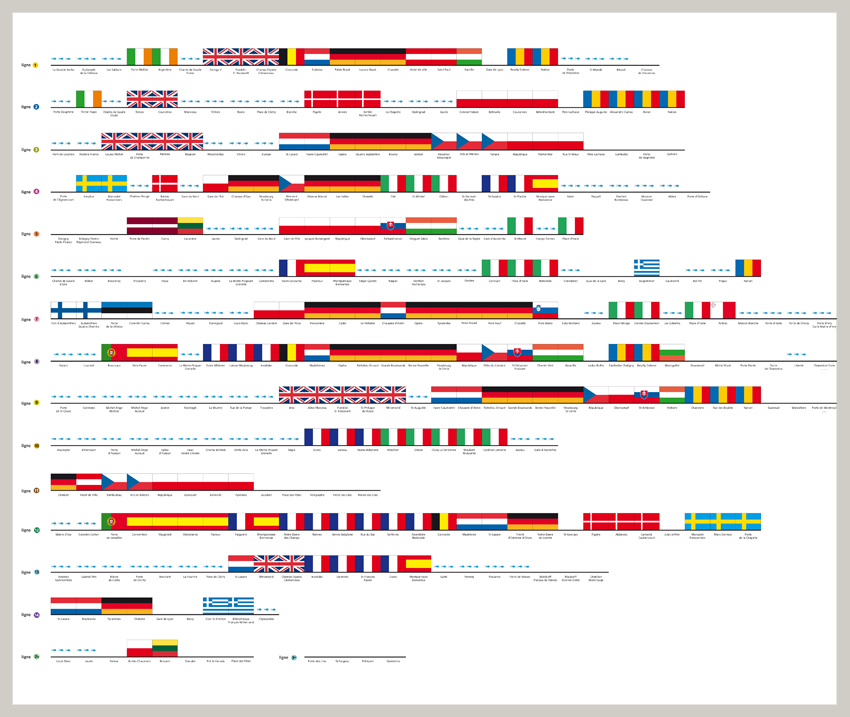
The ultimate goal of the project is that each area of Paris would have a corresponding state of the European Union for a period of six months. This principle was adaptable on several levels and various scales in the city. We specifically developed the project for public spaces in Paris, such as the 140 stations of the RATP.
This project was unfortunately not realized.
